HRRR - High Resolution Rapid Refresh
| Provider: | National Centers for Environmental Prediction, NOAA (USA) |
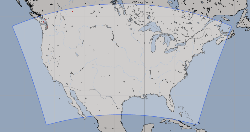
| Model scope: | North America |
| Update frequency: | every hour |
| Resolution: | 1.6nm, 3.0km |
| Model duration: | 19 forecasts starting at 0 hr, ending at 18 hrs |
| Parameters: | pressure, wind, wind gust, rain, cloud, temperature, humidity, dew point, convection, smoke, simulated radar, precipitable water, lightning, visibility, 0C isotherm, 250 mb, 500 mb, 850 mb |
| GRIB model date: | Wed Apr 24 21:00:00 2024 UTC |
| Download date: | Wed Apr 24 22:33:16 2024 UTC |
| Download delay: | 1hr 33min |
Note: the Download delay is the amount of time required for the GRIB model to compute its forecast and then for the LuckGrib cluster to download the data and make it available. The LuckGrib delay is generally less than 10 minutes, the remainder of the delay is the model compute time.
Description
HRRR is a high resolution model offering short term forecasts updated every hour. Global, coarser resolution models have difficulty in providing useful information for sailors in inland waters. There are many examples of this - including the waters surrounding Puget Sound, or any of the many coastal bays such as San Francisco’s Bay area or the Chesapeake Bay area. With HRRRs 3km resolution, these areas now have access to high quality, short term forecasts.
The following description has been taken directly from the official documentation
The HRRR is a NOAA real-time 3-km resolution, hourly updated, cloud-resolving, convection-allowing atmospheric model, initialized by 3km grids with 3km radar assimilation. Radar data is assimilated in the HRRR every 15 min over a 1-h period adding further detail to that provided by the hourly data assimilation from the 13km radar-enhanced Rapid Refresh
There is a short video available which describes the model further.
Storms: Note that this model is intended to be able to resolve storms. If your interest in weather is storm related - either due to your living in a region that may be impacted by storms or for some other interest - this may be the best model for you to observe. Storms can change rapidly, and as this model is both updated hourly and has a high resolution, it may be the best choice for watching storms develop and progress.
Examples:
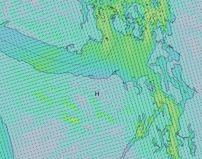
Note that all of the wind barbs in the image represent actual data points
from the HRRR model. There are many more data points than with the highest
resolution GFS model.
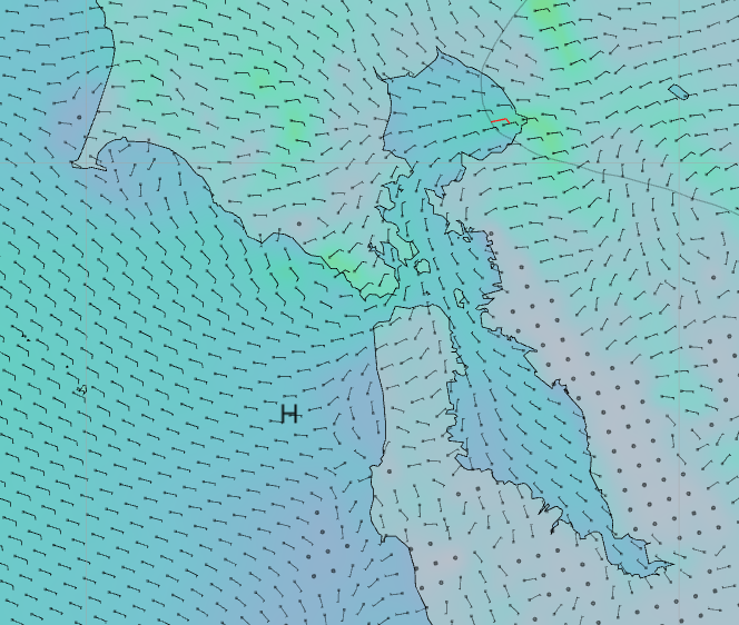
This is the San Franciso Bay Area. Again, note that the wind barbs are located on actual data points from HRRR. This is a high resolution model.