NAM Conus - North American Mesoscale Forecast System
| Provider: | National Centers for Environmental Prediction, NOAA (USA) |
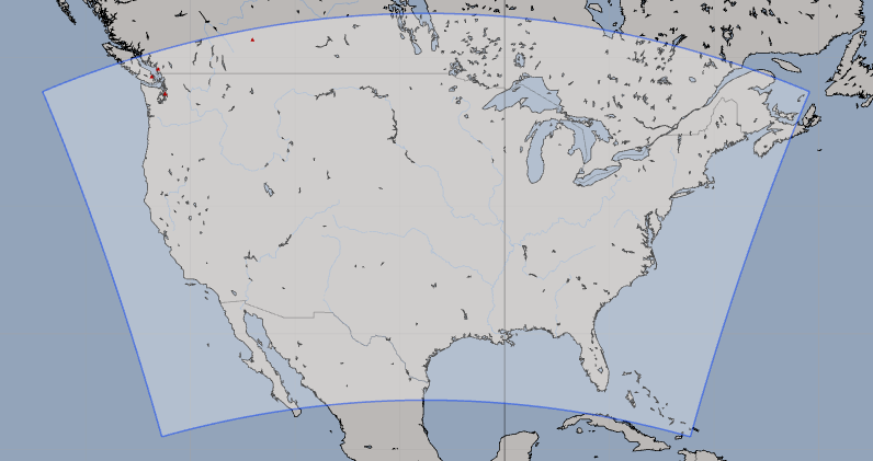
| Model scope: | North America |
| Update frequency: | every 6 hours |
| Resolution: | 1.6nm, 3.0km |
| Model duration: | 31 forecasts starting at 0 hr, ending at 2 days 12 hrs |
| Parameters: | pressure, wind, wind gust, rain, cloud, temperature, humidity, dew point, convection, vorticity, vertical velocity, simulated radar, precipitable water, visibility, 0C isotherm, 250 mb, 500 mb, 850 mb |
| GRIB model date: | Fri Apr 19 12:00:00 2024 UTC |
| Download date: | Fri Apr 19 14:48:19 2024 UTC |
| Download delay: | 2hr 48min |
Note: the Download delay is the amount of time required for the GRIB model to compute its forecast and then for the LuckGrib cluster to download the data and make it available. The LuckGrib delay is generally less than 10 minutes, the remainder of the delay is the model compute time.
Description
NAM Continental US is a high resolution nest, that runs within the larger NAM suite of models. NAM is a mesoscale model, which means that the numerical analysis is able to model land, and other features, at a higher resolution than in a global model, leading to improved forecast accuracy.
This model would be an excellent choice for a short range weather forecast for anybody living in an area covered by its domain.
Here is a quote from the NAM homepage:
The North American Mesoscale Forecast System (NAM) is one of the primary vehicles by which NCEP’s Environmental Modeling Center provides mesoscale guidance to public and private sector meteorologists.
For additional information, see: