OFS Salish Sea and Columbia River Currents
| Provider: | Center for Operational Oceanographic Products (NOAA) |
| Model scope: | North America West Coast |
| Update frequency: | every 6 hours |
| Resolution: | 0.3nm, 0.6km |
| Model duration: | 73 forecasts starting at 0 hr, ending at 3 days |
| Parameters: | current, tide |
| GRIB model date: | Fri Apr 26 21:00:00 2024 UTC |
| Download date: | Sat Apr 27 01:08:24 2024 UTC |
| Download delay: | 4hr 08min |
Note: the Download delay is the amount of time required for the GRIB model to compute its forecast and then for the LuckGrib cluster to download the data and make it available. The LuckGrib delay is generally less than 10 minutes, the remainder of the delay is the model compute time.
This Model is in Development
Warning: this SSC OFS model is currently under development by the OFS team. This data is offered through LuckGrib for evaluation purposes only.
The model data is not being generated by an operational team, and may stop updating for a variety of reasons. This is not unusual for forecast models while they are under development.
Description
The Operational Forecast System (OFS) series of models is run by the National Ocean Service (NOS) and the National Weather Service’s (NWS), both a part of the National Oceanic and Atmospheric Administration (NOAA).
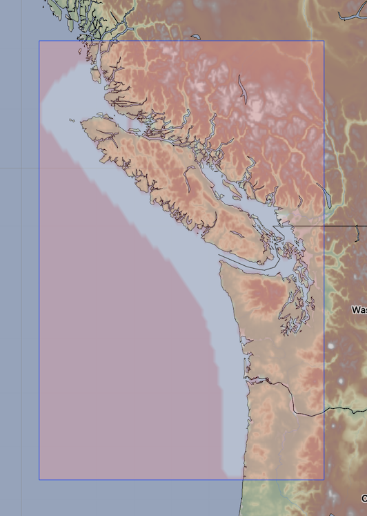
 https://tidesandcurrents.noaa.gov/images/ofs/sscofs_spatialmap.png
The Salish Sea and Columbia River OFS model is calculated using a bathymetry following irregular grid which has almost 240,000 grid nodes. The results of this computation are then sampled, by OFS, into a regular latitude / longitude aligned grid. This data on this regular grid are then converted to GRIB format by LuckGrib.
Additional information
For additional information, see: