RTOFS Global HYCOM - Ocean Currents
| Provider: | National Centers for Environmental Prediction, NOAA (USA) |
| Model scope: | Global |
| Update frequency: | every 24 hours |
| Resolution: | 0.08°, 4.8nm, 8.9km |
| Model duration: | 29 forecasts starting at 12 hrs, ending at 8 days |
| Parameters: | current, water temperature, ice |
| GRIB model date: | Fri Jul 11 00:00:00 2025 UTC |
| Download date: | Fri Jul 11 16:10:07 2025 UTC |
| Download delay: | 16hr 10min |
Note: the Download delay is the amount of time required for the GRIB model to compute its forecast and then for the LuckGrib cluster to download the data and make it available. The LuckGrib delay is generally less than 10 minutes, the remainder of the delay is the model compute time.
Description
This model provides forecasts for global ocean currents, at a high resolution.
The global operational Real-Time Ocean Forecast System (Global RTOFS) at the National Centers for Environmental Prediction is based on an eddy resolving 1/12° global HYCOM (HYbrid Coordinates Ocean Model) …
If you are interested in the Gulf Stream, you should also consider the US-East Coast NCOM model.. Sailors in the Caribbean will also have access to NCOM Caribbean.
This model is refreshed at around 16:00 UTC every day.
A note on the original data
RTOFS is provided by NCEP in its native form, and is defined using a rather unusual pair of projections. The data is provided in a rectangular grid with size 4500 x 3298. The data spans the globe horizontally, and has data down to 78.6 S.
South of 47 degrees N, the data is in a mercator grid, which has a nominal resolution of 0.08 degrees at the equator. As you progress away from the equator, the resolution of adjacent longitudes remains fixed at 0.08, however the step between adjacent latitudes decreases.
North of 47 degrees N, the data is in a Arctic bi-polar projection. This projection essentially forms a cap over the top of the earth, forming a seal at 47 N.
An image of this projection is here:
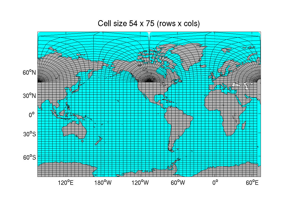
The projection is described in more detail here.
A note on the data provided
LuckGrib provides all of its data in GRIB format, and GRIB data requires that it be defined in as single projection defined on a regular grid.
The RTOFS data is provided in a latitude / longitude projection, similar to GFS and many other global models. Data is provided from 72 S to 84 N, at a regular 0.08 degree spacing.