NAM - North American Mesoscale Forecast System
| Provider: | National Centers for Environmental Prediction, NOAA (USA) |
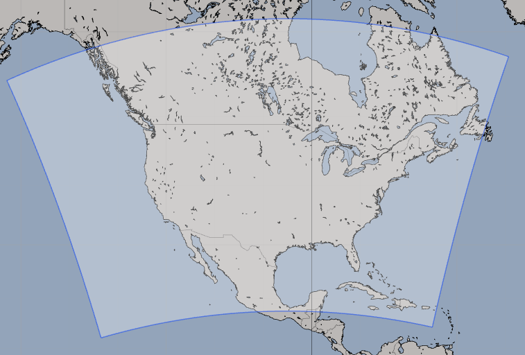
| Model scope: | North America |
| Update frequency: | every 6 hours |
| Resolution: | 0.108°, 6.5nm, 12.0km |
| Model duration: | 35 forecasts starting at 0 hr, ending at 3 days 12 hrs |
| Parameters: | pressure, wind, wind gust, rain, cloud, temperature, humidity, dew point, convection, vorticity, vertical velocity, simulated radar, precipitable water, visibility, 0C isotherm, 250 mb, 500 mb, 850 mb |
| GRIB model date: | Sun Jul 19 12:00:00 2026 UTC |
| Download date: | Sun Jul 19 14:44:37 2026 UTC |
| Download delay: | 2hr 44min |
Note: the Download delay is the amount of time required for the GRIB model to compute its forecast and then for the LuckGrib cluster to download the data and make it available. The LuckGrib delay is generally less than 10 minutes, the remainder of the delay is the model compute time.
Description
NAM is one of NOAA’s major weather models, which in this case covers most of North America. NAM is a mesoscale model, which means that the numerical analysis is able to model land, and other features, at a higher resolution than in a global model, leading to improved forecast accuracy.
For additional information, see: