OFS Delaware Bay Currents
| Provider: | Center for Operational Oceanographic Products (NOAA) |
| Model scope: | North America East Coast |
| Update frequency: | every 6 hours |
| Resolution: | 0.3nm, 0.6km |
| Model duration: | 48 forecasts starting at 1 hr, ending at 2 days |
| Parameters: | current, tide |
| GRIB model date: | Thu Jul 2 00:00:00 2026 UTC |
| Download date: | Thu Jul 2 01:34:15 2026 UTC |
| Download delay: | 1hr 34min |
Note: the Download delay is the amount of time required for the GRIB model to compute its forecast and then for the LuckGrib cluster to download the data and make it available. The LuckGrib delay is generally less than 10 minutes, the remainder of the delay is the model compute time.
Description
The following text has been taken from the OFS site which describes this model:
For decades, mariners in the United States have depended on NOAA’s Tide Tables for the best estimate of expected water levels. These tables provide accurate predictions of the astronomical tide (i.e., the change in water level due to the gravitational effects of the moon and sun and the rotation of the Earth); however, they cannot predict water-level changes due to wind, atmospheric pressure, and river flow, which are often significant.
DBOFS was developed in a joint project of the NOAA/National Ocean Service (NOS)/Office of Coast Survey, the NOAA/NOS/Center for Operational Oceanographic Products and Services (CO-OPS), and the NOAA/National Weather Service (NWS)/National Centers for Environmental Prediction (NCEP) Central Operations (NCO) using Rutgers University’s Regional Ocean Modeling System (ROMS). DBOFS generates water level, current, temperature and salinity nowcast and forecast guidance four times per day. Aerial animations of the whole Delaware Bay as well as time series at particular stations or points of interest are available for 20 locations for the five parameters (water level, currents, temperature, and/or salinity).
DBOFS runs on NOAA’s High Performance Computers (HPC) in a new Coastal Ocean Modeling Framework (COMF) developed by CO-OPS. As a result, DBOFS has direct access to NWS operational meteorological products that it needs to run reliably.
DBOFS is based on a three-dimensional, high resolution model and with the added reliability of running at NOAA’s HPC, DBOFS will assist U.S. port authorities and mariners in efficiently navigating the Delaware Bay without compromising safety.
Grid
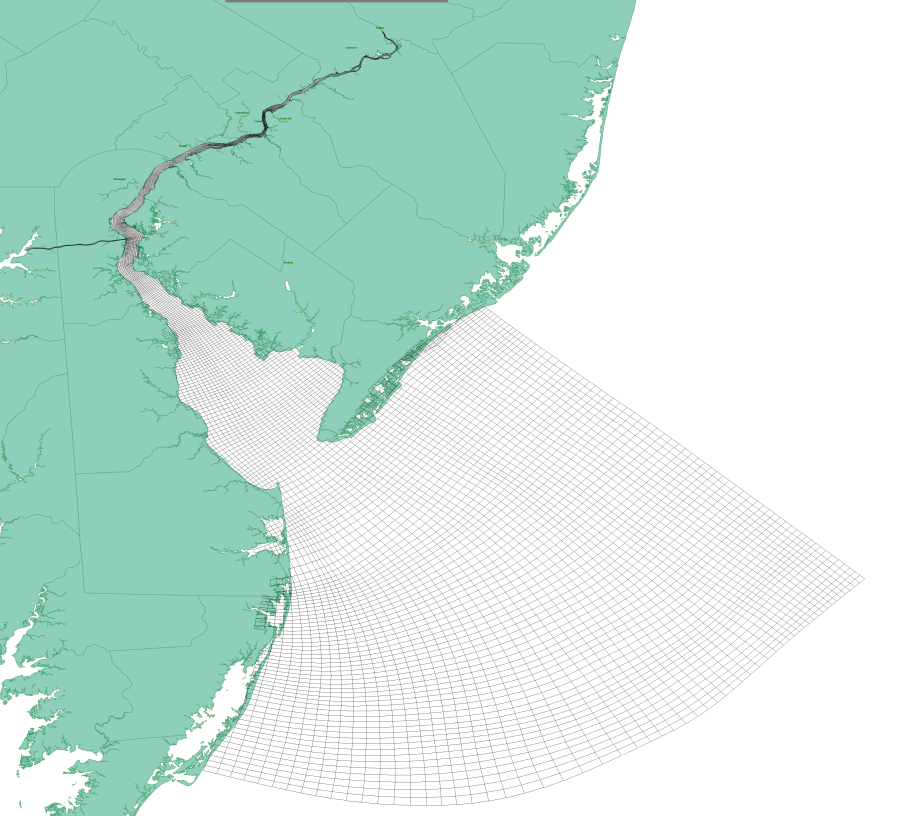 https://tidesandcurrents.noaa.gov/images/dbofs_grid.png
The Delaware Bay OFS model is calculated using a bathymetry following irregular grid which has over 87,000 grid nodes. The results of this computation are then sampled, by OFS, into a regular latitude / longitude aligned grid. The data on this regular grid are then converted to GRIB format by LuckGrib.
Additional information
For additional information, see: