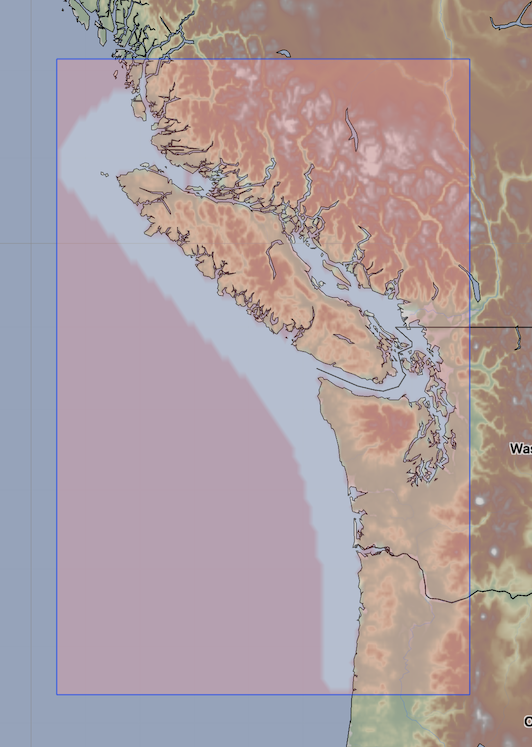
OFS Salish Sea and Columbia River Currents
| Provider: | Center for Operational Oceanographic Products (NOAA) |
| Model scope: | North America West Coast |
| Update frequency: | every 24 hours |
| Resolution: | 0.3nm, 0.6km |
| Model duration: | 57 forecasts starting at 0 hr, ending at 3 days |
| Parameters: | current, tide |
| GRIB model date: | Sat Jul 25 03:00:00 2026 UTC |
| Download date: | Sat Jul 25 07:27:33 2026 UTC |
| Download delay: | 4hr 27min |
Note: the Download delay is the amount of time required for the GRIB model to compute its forecast and then for the LuckGrib cluster to download the data and make it available. The LuckGrib delay is generally less than 10 minutes, the remainder of the delay is the model compute time.
Description
The following text has been taken from the OFS site which describes this model:
The Salish Sea and Columbia River Operational Forecast System (SSCOFS) provides the maritime user community with nowcast (analyses of present conditions) and forecast guidance of water levels, currents, water temperature, and salinity out to 72 hours, four times per day.
The three-dimensional SSCOFS was developed as part of a joint project of the NOAA/National Ocean Service’s Center for Operational Oceanographic Products and Services (CO-OPS) and Office of Coast Survey, the NOAA/National Weather Service’s (NWS) National Centers for Environmental Prediction Central Operations, the Battelle - Pacific Northwest National Laboratory, and the University of Massachusetts-Dartmouth.
The SSCOFS runs on NOAA’s Weather and Climate Operational Supercomputing System (WCOSS) in a Coastal Ocean Modeling Framework developed by CO-OPS. As a result, the SSCOFS has direct access to the NWS operational meteorological products that it needs to run reliably.
Historically, mariners have had to depend on NOAA’s Tide Tables for the best estimates of expected water levels and currents. These tables provide accurate predictions of the astronomical tides and currents due to the gravitational effects of the moon and sun combined with the rotation of the Earth. However, they cannot predict changes due to wind, atmospheric pressure and river flow, which are often significant. Furthermore, in most water bodies, predictions are available at a few locations only. Ocean models such as the Finite-Volume, Coastal Ocean Model (FVCOM), which is the basis for the SSCOFS, provide mariners with the best available water levels, currents, water temperature, and salinity forecast guidance.
Grid
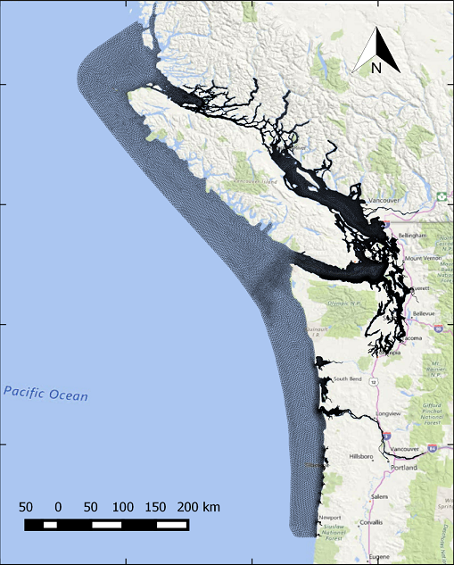 https://tidesandcurrents.noaa.gov/images/ofs/sscofs_spatialmap.png
The Salish Sea and Columbia River OFS model is calculated using a bathymetry following irregular grid which has almost 240,000 grid nodes. The results of this computation are then sampled, by OFS, into a regular latitude / longitude aligned grid. The data on this regular grid are then converted to GRIB format by LuckGrib.
Tide data
Note that the OFS models contain tide height data. This tide data may be superior to the official forecasts, as they take into account atmospheric conditions and river runoff.
Studying the tidal heights across this region using the visual tools in LuckGrib can be an excellent way to understand how tides progress the further away from an ocean inlet an area is.
Additional information
For additional information, see: