Update Oct 28, 2018: The v3.1 version of the NBM model is now available, read about it here.
—
Four new models have been added to the LuckGrib suite of models. These models are from The National Blend of Models.
The four models are:
These models can be neatly divided into two categories, as NBM Oceanic is quite different from the other three.
NBM Oceanic is updated twice a day. The Conus, Alaska and Hawaii versions of NBM are updated every hour.
About the National Blend of Models
The National Blend of Models (NBM) is an interesting suite of models, well worth considering as you evaluate weather systems.
The following is from an online description of the NBM:
The National Blend of Models (NBM) is a nationally consistent and skillful suite of calibrated forecast guidance based on a blend of both NWS and non-NWS numerical weather prediction model data and post-processed model guidance. The goal of the NBM is to create a highly accurate, skillful and consistent starting point for the gridded forecast. This new way to produce NDFD grids will be helpful providing forecasters with a suite of information to use for their forecasts. The NBM is considered an important part of the efforts to evolve NWS capabilities to achieve a Weather-Ready Nation.
As of May/2026, the NBM model is now at version 5.0. There is an announcement which details the changes in this latest release.
As of Oct/2020, the NBM model is at version 4.0.
The quoted text above mentiones that both NWS and non-NWS models are blended into the NBM.
The list of model inputs, for version 3.0 of NBM, is:
- NAM (North American Mesoscale Forecast System - 12km)
- NAMNest (NAM 3km high resolution nest)
- GFS (Global Forecast System)
- GEFS (Global Ensemble Forecast System)
- GDPS (CMC - Environment Canada Global Deterministic – PoP12/QPF06 only)
- GEPS (CMCE - Environment Canada Global Ensemble)
- EKDMOS (Ensemble Kernel Density Model Output Statistics)
- Gridded GFS MOS (GMOS or MOSGuide)
- HRRR (High Resolution Rapid Refresh), CONUS only
- RAP (Rapid Refresh). (Also RAP Alaska)
- Gridded LAMP (GLMP Localized Aviation MOS Product), CONUS only
- HiResWindow ARW NCEP (High-Resolution Window Forecast System (HIRESW))
- HiResWindow NMMB NCEP (High-Resolution Window Forecast System (HIRESW))
- SREF (Short Range Ensemble Forecast) CONUS, Alaska, Puerto Rico sectors
- NAVGEME (Navy FNMOC Global Ensemble)
The update to NBM, version 3.1, has added the following model inputs:
- ECMWFD (European Centre for Medium-Range Weather Forecasts, deterministic - 0.25 degree)(CONUS, OCONUS) (0000, 1200 UTC runs)
- ECMWFE (European Centre for Medium-Range Weather Forecasts, Ensemble - 1.0 degree)(CONUS, OCONUS) (0000, 1200 UTC runs)
- NAVGEMD (Navy FNMOC Global deterministic - 0.50 degree For most elements, 1.0 degree for significant wave heights)(CONUS, OCONUS, and Oceanic domain) (0000, 0600, 1200, 1800 UTC runs)
- GDPS (CMCD Environment Canada Global deterministic model (25km) for weather elements other than PoP12/QPF06)
- RDPS (Canadian Regional deterministic model - 10km) (CONUS and Alaska) (0000, 0600, 1200, 1800 UTC runs)
- REPS (Canadian Regional ensemble model - 15km) (CONUS) (0000 and 1200 UTC runs) (Precipitation products only)
- HRRR Alaska (High Resolution Rapid Refresh - 3km) (a). 1-18 hours (0300, 0900, 1500, 2100 UTC runs) (b). 1-36 hours (0000, 0600, 1200, 1800 UTC runs)
- HiResWindow ARW Mem2 (3-km High-Resolution Window Forecast System (configured like NSSL WRF) (CONUS and OCONUS)
- WW3 (0.5 degree WaveWatchIII global deterministic model)
- WW3 (0.5 degree WaveWatchIII global ensemble model)
- WW3 (0.16 and 0.06 degree WaveWatchIII high resolution regional models) (CONUS and OCONUS)
- GLW (2.5km Great Lakes Wave model)
The v3.2 update to NBM has added the following model inputs:
- ACCESS-G (The Australian global model)
- GFS-FV3 visibility
- additional improvements for other weather elements (temperature, rain, …)
The v4.0 update to NBM has added the following model inputs:
- GFS-MOS (0000-, 0600-, 1200-, and 1800-UTC cycles)
- Deterministic ECMWF-MOS (0000- and 1200-UTC cycles)
- Ensemble ECMWF-MOS (0000- and 1200-UTC cycles)
- EKDMOS (0600- and 1800-UTC cycles)
- NAM-MOS (0000- and 1200-UTC cycles)
- LAMP (hourly)
The Blending Process
How the NBM blends all of its input forecast models into its result is described briefly in each of the models descriptions. For example, see the description for NBM Oceanic.
Briefly - there are many input forecast models which are intended to represent the wide range possible forecasts. This varied set of inputs is combined in a sophisticated blending process, resulting in a product that has higher forecast skill than its individual components. This is a very interesting new suite of models.
NBM Oceanic
The Oceanic version of the NBM is quite different from the other three. First, note that NBM Oceanic has by far the largest domain of these four models, covering most of the Pacific and Atlantic oceans, down to 20° south at a 10km resolution.
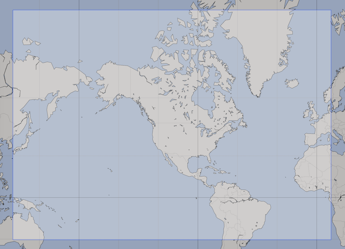
Recall that most of the global weather models, such as GFS and CMC GDPS offer a 0.25° resolution. 0.25° is roughly 28km, so the Oceanic domain of the NBM is almost three times the resolution of comparable global models.
While NBM Oceanic is not a global model, it covers a very interesting domain at a finer resolution than has been previously available.
The second major difference between NBM Oceanic and the other three models is that NBM Oceanic contains probabilistic data. For example, there are five wind speeds present for each point in NBM Oceanic, each assigned one of five probabilities. By examining the spread of these wind speeds, you can determine the certainty of the result.
NBM Oceanic is a weather forecast model which is able to express the degree of certainty it has in its results. This is a crucial difference between this model and all other models.
A short tutorial is available, describing the NBM Oceanic probabilistic data in some more detail.
NBM Conus, Alaska, Hawaii
Each of these three versions of NBM are more traditional, in that the data they contain do not have associated probabilities.
These three regional models have a higher resolution than the Oceanic domain. Where Oceanic has a 10km resolution, Conus and Hawaii have a 2.5km resolution and Alaska is 3km.
Conclusion
The NBM data represent a new resource for the weather community to consider. Feedack is welcome on how useful you find these models.